Wild camping in Bosnia: rules and landmines
What is known about wild camping in Bosnia, which rules apply in Una National Park and how to spot signs of landmines. Factual, with sources.
As of October 2026. Rules can change. Check your foreign ministry's travel advice before you set off.
Are you allowed to park up freely in Bosnia and Herzegovina or pitch your tent anywhere? Here is what is known about the rules. And why you should stick to well-used paths when you are out and about. The basics of the trip are covered in Camping in Bosnia: tips before you travel.
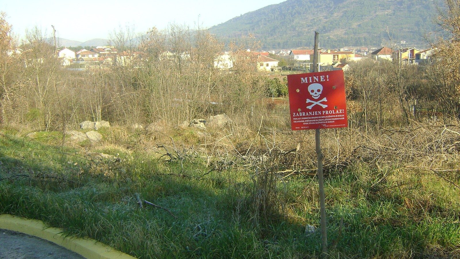 Mine warning sign in Herzegovina.
What is known about wild camping
We have not found a law that regulates wild camping across the whole country. That applies to the Federation, Republika Srpska and Brčko District. So as far as we can tell, the legal situation is unclear.
The Swiss motoring club TCS is clear: "Wild camping is generally prohibited." Travel blogs often say it is tolerated. That is not evidence.
Una National Park: clear rules
Una National Park has its own law from 2008. Among other things, it prohibits:
- parking motor vehicles or caravans outside the designated areas
- pitching tents outside designated areas
- lighting fires outside designated areas
- letting dogs off the lead outside settlements
A violation costs private individuals 20 to 1,500 KM. We have not checked whether the law has been amended since 2008.
For Sutjeska and Kozara national parks and for Blidinje and Hutovo blato nature parks, we have not found any documented camping rules. Ask locally before you pitch your tent.
Mines today: figures and regions
Bosnia and Herzegovina still has areas where mines are suspected. In January 2026 they covered 774.69 square kilometres, or 1.51 per cent of the country's territory. This is stated in the draft 2026 demining plan of the mine action centre BHMAC (as of July 2026). The BHMAC website still shows the older figure from January 2025, with 822.87 square kilometres.
Of the area in January 2026, around 624.5 square kilometres lie in the Federation and around 150.2 in Republika Srpska. In the Federation it is distributed across the cantons as follows (in square kilometres):
| Canton | Suspected area |
|---|---|
| Hercegovačko-neretvanski | 120.673 |
| Zeničko-dobojski | 105.572 |
| Srednjobosanski | 94.359 |
| Unsko-sanski | 83.629 |
| Kanton 10 | 58.244 |
| Tuzlanski | 57.749 |
| Sarajevo | 48.685 |
| Bosansko-podrinjski | 42.259 |
| Posavski | 13.336 |
The West Herzegovina Canton is missing from the table. The plan does not say whether this means there is no suspected area there.
Since 1996, BHMAC has counted 1,782 mine victims. According to the plan for 2026, the country will miss the clearance deadline of the Ottawa Convention in March 2027 and is applying for a further extension in 2026.
How to recognise danger zones
Mines and unexploded ordnance lie mainly away from the main routes. According to the Austrian Foreign Ministry, some minefields have not been cleared even along through roads. The German Federal Foreign Office writes that landslides after storms have shifted minefields. Markings are often no longer visible.
The warning sign is red, with a skull and the white lettering "PAZI-MINE" or "MINE-ZABRANJEN PROLAZ". But many areas are not marked at all. Signs have been destroyed or stolen.
The BHMAC guide names places where mines may lie:
- former front lines
- abandoned houses, wells and ruins
- riverbanks and springs
- the edges of roads, railway lines, power lines, tunnels and bridges
Ammunition boxes and craters are warning signs too.
Rules of conduct outdoors
The German Federal Foreign Office advises against leaving paved roads, including near Sarajevo. Do not enter fallow land or ruins. The Swiss EDA adds unmown meadows and ruined houses to this. It advises sticking to frequently used paths and only going hiking with a local guide. BHMAC puts it this way: only walk on well-trodden, used paths and never go alone into unknown terrain.
For hiking, the German Federal Foreign Office also recommends marked trails. Leave your route with someone, take water with you and be back before dark.
If you suddenly find yourself in a minefield: stay where you are, do not move and call for help. Nobody should walk in to help you.
If you find something suspicious, mark the spot and do not touch anything. Inform civil protection (Civilna zaštita) or the police.
Map, app and emergency numbers
BHMAC offers the app "Mine Suspected Areas". The guide warns, however: do not use the app for navigation at the edge of suspected areas. BHMAC provides mine maps on request by email at info@bhmac.org. The municipalities can also give you information. The EDA likewise refers to BHMAC.
The BHMAC guide gives these numbers:
- Police: 122
- Civil protection: 121
- BHMAC: 033/253-800
The Austrian Foreign Ministry lists 121 as mountain rescue. According to the German Federal Foreign Office, you can reach the GSS mountain rescue service at +387 63 11 22 33. The fire brigade is 123, ambulance 124. Do not rely on 112: according to the legal portal paragraf.ba, it had not yet been introduced in September 2024. Whether that has changed since is not documented.
The alternative: staying with hosts
If you do not want to guess whether you are allowed to stay somewhere, stay with a host. With hosts on Camplix, you send your request through us, in English. Ask at the same time where your tent or motorhome can go. You can find all hosts on the map. If your dog is coming along, also read With your dog to Bosnia and back into the EU.
Sources
- TCS: country information for Bosnia and Herzegovina, undated, accessed October 2026
- Law on Una National Park (Zakon o nacionalnom parku „Una“, Sl. novine FBiH 44/08), PDF, 2008
- BHMAC: Plan deminiranja u BiH za 2026 (draft demining plan), PDF, 07/2026
- BHMAC: current mine situation, as of 01/2025
- BHMAC: questions and answers, undated, accessed October 2026
- BHMAC: short guide to mine risk (draft), PDF, 06/2024
- App Store: Mine Suspected Areas, accessed October 2026
- German Federal Foreign Office (Auswärtiges Amt): Bosnia and Herzegovina, travel and safety advice, as of 19 October 2026
- Austrian Foreign Ministry (BMEIA): travel information for Bosnia and Herzegovina, as of 19 October 2026
- EDA: travel advice for Bosnia and Herzegovina, on site, updated 30 April 2026
- paragraf.ba: report on the emergency number 112, 17 September 2024