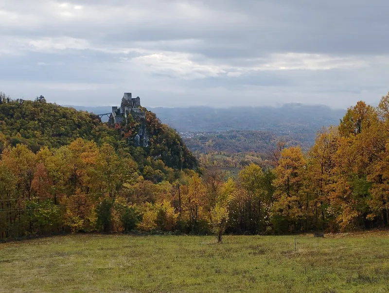
A medieval border stronghold
Srebrenik lay between the Pannonian plain and the Bosnian highlands, near the eastern border of the medieval župa of Usora, and protected the land south of the Sava against Hungarian ambitions. It is first recorded in 1333: on 15 February, Ban Stjepan II issued, below its walls, the charter renouncing Ston.
In 1393, during King Sigismund's campaign, Srebrenik first fell to Hungary, which took it again in 1405, 1408 and 1410. In 1408 Sigismund gave it, in name only, to the Serbian despot Stefan Lazarević; the Hungarian garrison stayed and is still recorded in 1430. Masters from Dubrovnik then did building work there at the invitation of a local lord, knez Matej. In 1452 it passed with Usora to Despot Đurađ Branković, who handed it to the Hungarian governor Janko Sibinjanin that same year. Together with Doboj, Soko and Teočak, Srebrenik formed the southern of two lines of fortresses between the Sava, the Drina and the Bosna.
Between Hungary and the Ottomans
In 1462 the Ottomans took the fortress. However, they left only small garrisons in the strongholds of the area and had to withdraw because of poor supplies. In autumn 1464 an army of King Matthias Corvinus of Hungary struck north-eastern Bosnia, taking Srebrenik first. The fortress became the seat of the Banate of Srebrenik, which covered Usora, Soli and Spreča. When the Ottomans finally took it is not known exactly; the only certainty is that they conquered the area for good between 1510 and 1519.
Under Ottoman rule Srebrenik had a permanent garrison of 48 mustahfiz, which had shrunk to 21 by 1548. Below the fortress lay a small suburb of 10 to 20 houses with a market, and inside the walls a mosque was built for the garrison and the people of the suburb. Between 1701 and 1730 Srebrenik became part of the Gradačac captaincy. Repairs are recorded for 1756 and 1777; in 1804 the garrison numbered some 20 men, and in 1833 there were 7 cannon in the fortress. The army left after 1835, while the mosque was kept up for a few more decades.
A walk through the fortress
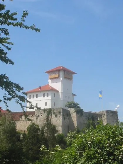
The layout follows the terrain: the crag rises 50 to 70 metres above its surroundings, and the fortress is squeezed onto about 60 by 30 metres. It is reached by a bridge over a deep ditch and entered through the gate tower on the south-eastern side. A crescent is carved at the foot of the gate arch; between the windows above it sat a plaque, probably bearing a chronogram, which was found shot to pieces as early as 1954. The tower survives up to the roof line, 7.5 metres high.
In the northern bailey, the walls, 2.10 metres thick, have 7 openings for cannon. In Tower III, with its cistern, the Ottomans built a mosque that was still in use at the end of the 19th century. At the top of the site stand the main tower, a cistern and a residential building with a cellar. The main tower had neither fireplace nor ablution niche, so nobody lived in it permanently. In the residential building, probably the Ottoman garrison's quarters, a corridor led to four rooms, each with an ablution niche, a stove and a window.
The outer walls are about 1.5 metres thick. According to Đuro Basler, almost the whole fortress was rebuilt in the 18th century. Some 17 metres in front of the entrance stands the half-collapsed ruin of a detached tower.
Protection and visiting
In 1962 the fortress was entered in the register of immovable cultural monuments. From 1975 to 1978 all its buildings were conserved and a new access bridge was built; the present bridge dates from 2003 to 2004. In November 2004 the Commission to Preserve National Monuments declared the walls, the ruin of the detached tower and the bridge a national monument. The site has not been excavated and is treated as an archaeological reserve. The decision provides for the site to be open to the public and usable for education and culture.