A Roman fort and the Hrvatinići
Ključ lay where two ancient highways crossed, one from Salona to Siscia along the Sana valley and one from Salona to Servitium via Pecka, and both stayed in use in the Middle Ages. The Romans had already built a strong fort here to watch over the important crossing of the Sana; traces of a smaller Roman fort survive near the Ljubica tower.
Ivo Bojanovski suggests that the medieval castle was founded in the 13th century. It is first named explicitly in a charter by which Ban Stjepan II Kotromanić granted the castles of Ključ and Kotor to Vukoslav Hrvatinić; in 1325 Vukoslav was styled prince of Ključ. In 1446 King Tomaš confirmed Ivaniš Dragišić and his sons in its possession in a charter issued at Vranduk; this is the first mention of the settlement of “Pod Ključ” below the castle.
The last king and the Ottomans
When Ottoman pressure forced the capital of the Bosnian state to move west, the area grew in importance, and the presence of the king and his court gave trade and the local economy a boost. In 1463 the last Bosnian king, Stjepan Tomašević, tried to take refuge in Ključ but was taken prisoner. From 1463 until 1878 Ključ was part of the Ottoman Empire. A permanent garrison under a dizdar held the castle until 1838, and in the late 17th century a kapetan was also based here. A certain Hadži Osman built a mosque in the town, which had eight staff in 1775. In 1878 fighting broke out below the town with the Austro-Hungarian army.
Castle, Ljubica tower and Tabori
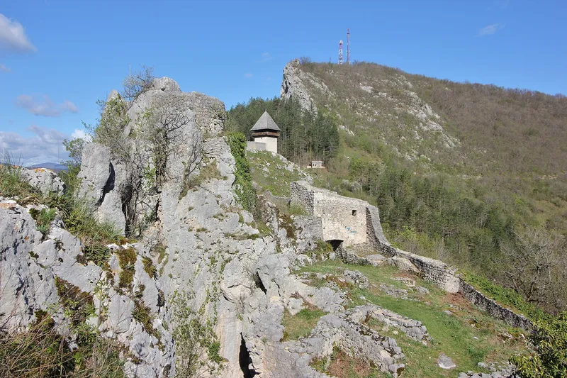
The site consists of three separate parts with no common curtain wall. The castle proper runs for some 125 metres from west to east along a narrow rocky ridge, is 5 to 13 metres wide inside and covers about 850 square metres. A sheer drop into a deep ravine protects it to the south and a high wall to the north. The hexagonal watchtower stands at the west end; around the turn of the 15th to the 16th century it was lowered and filled in against artillery, while the north wall was thickened from 1.1 to 2.1 metres. A narrow courtyard 35 metres long leads to the eastern part with the gate tower, the palace, two cisterns and a gun emplacement above the Sana gorge. The two-storey gate tower is Ottoman, since the engravings in Kuripešić's travel account from the 1530s still show the entrance in the wall. The palace covered about 300 square metres and had an upper floor; its north wall still stands 5.5 metres high.
The free-standing round Ljubica tower on the highest point of the rock to the west, 6 metres in diameter and probably from the 15th century, guarded the approach against besiegers. About 150 metres north-west of the gate tower lie the Tabori, medieval outworks that the Ottomans rebuilt as a triangular enclosure with corner towers. Excavations from 1969 onwards yielded maiolica, stove fragments and cannon balls, and the finds went to the Museum of Bosanska krajina in Banja Luka. The complex was conserved between 1986 and 1989.